Building date: Fell into disrepair and was razed sometime after 1976 fire.
Original use:
Corner structures:
Mortar application and content:
Types and uses of stones:
Types and choice of windows:
Structures with similar masonry details:
Masons who worked on building:
Unique features:
Map views courtesy Google Maps, Aug 2007 road level view. Address is Google Earth approximate; 42°44'47.69"N 77°446'32.65"W.
Town of Groveland and Livingston County Highway 1976 Maps
Samuel C. Culbertson House history sheet. From the personal research of cobblestone historian Karen Crandall.
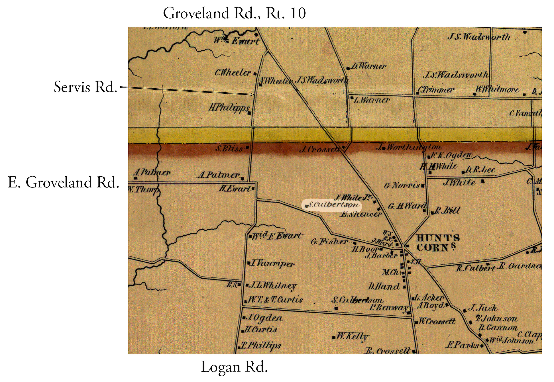 1852 Livingston County Map Gro-2 Excerpt.jpg ¹ | 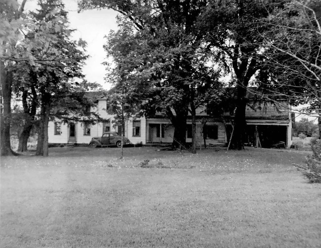 c 1950 Culbertson House.jpg ¹ c. 1950 | 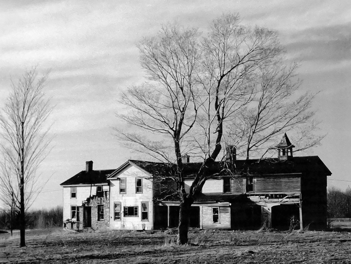 c 1976 Culbertson House.jpg ¹ c. 1976 |
¹ 1852 Livingston County Map Excerpt Pro-2 courtesy Library of Congress.
